Features
Emergency & disaster management
Hot topics
Disaster response
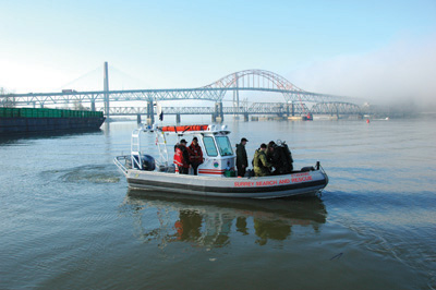
It’s every first responder and dispatcher’s nightmare – a 911 call for help from a visitor to the area, on a cell phone and not able to provide to provide accurate location information. Now, imagine that the call is from an elite team of military divers, somewhere on B.C.’s Fraser River.
November 14, 2008
By Paul Dixon
 |
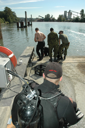
| Divers prepare to enter the Fraser River above the New Westminster train bridge. Photos by Paul Dixon |
Exercise identifies locations, response routes for police, fire, EMS to large-scale incident in B.C.
It’s every first responder and dispatcher’s nightmare – a 911 call for help from a visitor to the area, on a cell phone and not able to provide to provide accurate location information. Now, imagine that the call is from an elite team of military divers, somewhere on B.C.’s Fraser River.
With that in mind, the task was to create a pre-plan that would identify locations and response routes, enabling emergency medical response, both land-based and helicopter, in support of the 1st Combat Engineer Regiment dive team, who would be conducting a series of high-risk dives in the Fraser River in August 2007.
Mike Andrews, regional manager with B.C.’s Provincial Emergency Program (PEP), explains the presence of the dive team.
“For the past three years, as part of the ongoing planning and preparation co-operation between the federal and provincial governments, the dive team from 1st Combat Engineer Regiment stationed in Edmonton, has come down to the Greater Vancouver region to assist us with several of our ongoing projects, in particular those dealing with assessing disaster response routes. Our working groups are looking at ways of expediting movement of first responders – police, firefighters and paramedics especially – if the bridges are impacted across the region. It may not be possible to move them by helicopter in the first hours following an incident, so that is why we are identifying the key points on the local rivers that would enable us to use marine transportation to fill that gap.
 |
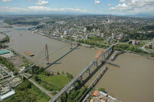
| The bridges over the Fraser River at New Westminster are (left) Skytrain (rapid transit), Patullo and the New Westminster train bridge. Surrey is at the bottom of the picture, looking southwest over New Westminster, the mountains of Vancouver Island are visible in the distance. Photos by Paul Dixon |
“Ultimately, we would be able to move response vehicles and heavy equipment around the region by tug and barge as needed. This is what the army divers have been doing for the past three years, diving on various bridges, docks and privately owned facilities in the rivers and Vancouver harbour to assess the soundness of various structures and familiarize themselves with the region.
“It’s a great experience for the dive team, because they see it as a real contribution to the community at large. The work is challenging and outside their normal scope of operations. The property owners gain by having an underwater inspection of their facilities at no cost. It’s a win-win situation.”
The plan called for the divers to conduct underwater inspections of three critically important railway mainline bridges spanning the Fraser in the Greater Vancouver area: the Canadian Pacific bridge at Mission; the Canadian National New Westminster bridge; and CP’s Pitt River bridge. These bridges are critical to the ongoing operation of CN and CP mainline operations serving central Canada and the U.S. through the port of Vancouver and would be critical to any post-disaster response and recovery in south-west British Columbia.
Diving in the Fraser River is dangerous at any time. It’s a big, fast-moving river, full of silt that reduces visibility to zero. The piers of the bridges are magnets for debris carried along by the current and large buildups of debris can accumulate. The Mission bridge is built on a series of wooden pilings, which are especially prone to debris buildup and can trap unseen debris underwater, creating additional deadly hazards. While the Pitt River and New Westminster bridges are larger and are built on stone and concrete piers, the river is tidal in those areas, which creates another set of safety issues. This can result in tremendous backflow forces when the tide is rising and increased outflow when the tide is falling. Even at periods of apparent slack water, there are tremendous underwater back eddies and currents that are not readily discernible from the surface.
 |
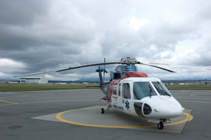
| A B.C. Ambulance Service air ambulance, a Sikorsky S76, on the tarmac at its base at Vancouver International Airport. Photos by Paul Dixon |
In pre-planning emergency medical support to the dive missions, organizers took the approach of identifying hazards and determining risk to the patient after something had happened and then developed response protocols to minimize response times and provide the most appropriate level of response. Initially, Derek McClure, superintendent of B.C. Ambulance’s Lower Mainland Regional Communications Centre, and a group including a B.C. Ambulance air operations supervisor did a reconnaissance of the areas around the three proposed bridge dives on foot and by vehicle to determine how to best approach the sites from the air and by road. Even more important was identifying places along the river’s edge where a small boat could be brought to shore and a patient removed. To the uninitiated, it seems a simple process, nothing more than making some dots on a map of the most likely spots. The reality is much more complicated because of the fast-moving water. Given the steep banks or dikes and the accumulated debris clinging to them, there are few spots at which a boat could be landed. It is equally as challenging to find a landing spot for an air ambulance that is also accessible by road. The choices were extremely limited.
For the Mission bridge, it was determined that the best spot for an air ambulance landing zone was in the regional park across the river and downstream from where the boat launch was located. The irony was that the boat launch is located beside the north side of the bridge, but it’s not suitable for a helicopter landing zone. The park site had a large sandy beach on the lee side of the river and good road access for land ambulance and first responders.
For the Pitt River bridge, even after close inspection of the area, it was determined that it would be necessary to return to the boat launch site at the confluence of the Pitt and Fraser rivers, as there are very limited landing opportunities in the area.
For the New Westminster bridge, it was determined that air ambulance was not to be employed, as this area is in the built-up urban core of Greater Vancouver, there are several decent docks adjacent to the bridge and the local trauma centre, Royal Columbian Hospital, is just a kilometre from the bridge site.
McClure explains how the location information works within the computer-aided design (CAD) system. “We create a location of interest within the addressing function of our CAD system using GPS co-ordinates. For practical purposes, that means we create a street address for a location that has no actual address. This allows our call takers to enter the information into the CAD system and generate an incident without having to guess at where the call is. It also allows us to associate information to that address, such as contact information that would be specific to this one event. We do an information sheet for our dispatch supervisors, as well as the dispatcher(s) working the channel responsible for that area. The same information goes out to the street supervisor of the ambulances working in that region. By giving our call takers, dispatchers and street crews the information in advance, it gives them a heads up if and when a call does come from one of these special events.”
 |
| Two divers enter the Fraser River, with the third acting as the rescue diver. Photos by Paul Dixon |
The B.C. Ambulance Service’s Vancouver communications centre is responsible for an area of more than 13,000 square kilometres on the mainland of south-west British Columbia, from the urban core of Greater Vancouver through the Fraser Valley delta and an arc of more than 200 kilometres from beyond Whistler in the north across the rugged coastal mountains to Manning Park in the south east. Within this area, BCAS is also responsible for initiating first responder dispatch from more than 45 departments. In a program developed by McClure several years ago, the various fire dispatch centres in the region are directly linked to the BCAS CAD system. This is the First Responder Notification program; those departments that are first responders are automatically notified at the moment the BCAS call taker enters the call type and location into their CAD.
In a situation where the patient is mobile (in only the most catastrophic scenario would the response be out onto the river itself) and capable of being delivered to any one of several points, it is vitally important that the callers and responders be on the same page, literally. Dispatching responders to one side of the river and arriving to find the patient on the other side would be more than just inconvenient. While there is a highway bridge at Mission, the next bridge is more than 40 kilometres downstream. It’s not just a matter of driving to the other side.
Working from the hazard and risk, we developed three levels of response. One was an air response in situations of critical injury, where immediate evacuation to a trauma centre was required. The second would be a scenario that was within the scope of local ambulance and first responders. And the third would be a minor injury that could be addressed by the army medic(s) attached to the team and in which the injured party would be transported to a local hospital by military personnel.
For each of the three proposed dive sites, three spots were identified to where an injured diver could be transported by boat, to be met by land-based or air resources. These were identified by GPS co-ordinates, to be inserted into the BCAS CAD system, so that physical locations would be properly identified for responders. The GPS information and digital maps were forwarded to the military to be included in its dive plans.
The dive team was given a simple protocol to follow to maximize response effectiveness by giving them a script to follow. By alerting the BCAS communications centre each morning before starting their dives, BCAS staff were put on notice. If something did happen, one phone call through 911 to BCAS would initiate the most appropriate response based on need. At the client end, the dive team had only to refer to its map and state which of the pre-identified sites the patient would be taken to, allowing the responding ambulance crew to respond directly to the right place.
Last year was a record year for runoff on the Fraser. For several weeks, the level of the river in the upper Fraser Valley was described by provincial hydrologists as being “bank to bank”, meaning the river was as high as it could be without flooding. The speed and flow rate of the river were too far above the safety margins for the divers. Instead, they dove on a number of other structures in the river that were out of the main channel, as well as sites in Vancouver Harbour. Even though these dives did not approach the risk level of the bridge dives, the same concept of operations was used. Dive sites were identified to B.C. Ambulance and a phone call was made to its communications supervisor each day advising when the divers were about to enter the water; a second call was made at the end of the working day. A local liaison from the B.C. Provincial Emergency Program accompanied the dive team to expedite contact with local authorities and property owners.
Co-operation among all levels of government in planning for events ranging from disaster response to the 2010 Olympics is becoming more common. This is just one example of how a thorough pre-plan can solve problems well before they have a chance to happen.
For more information on utilizing GIS and GPS information within a CAD system, contact Superintendent Derek McClure – Derek.Mcclure@gov.bc
Paul Dixon (pd.dixon@shaw.ca) is a freelance writer and consultant focusing on emergency preparedness and emergency management. In 2007 he worked for the BC Provincial Emergency Program in the Freshet Planning Unit, doing advanced planning for the anticipated record runoff on the Fraser River. He worked with the military in this role and later served as the liaison for the dive team operations detailed in this article.
Print this page